Don’t count your chickens before they hatch.
Thus far, our story has centered around Colonel Sellers and University Heights, but what about the beginnings of some of the other neighborhoods that make up Nob Hill?
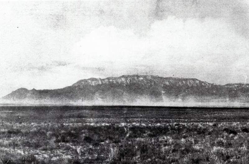
Up until about 100 years ago, there was minimal development in the Nob Hill area. The grasslands and sand dunes of the East Mesa, part of the Tigua (Tiwa) ancestral homelands, primarily served for grazing livestock with several dirt trails supporting east/west trade routes. Following the Mexican American War (1846-1848), through the Treaty of Guadalupe Hidalgo, Mexico ceded all territory east of the Rio Grande to the United States. This massive government land acquisition, coupled with the Homestead Act signed into law by President Abraham Lincoln in 1862, would set the table for the east mesa development we see today.
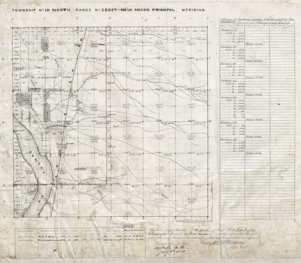
Nob Hill’s Homestead History
Much of the land on the East Mesa was privately acquired through this federal program enabled through the Homestead Act, which lasted until 1976. The concept was based on the idea that 160 acres would provide sufficient land to support an individual household. As one can imagine, homesteading 160 acres on the East Mesa sand dunes for 5 years was not for the faint of heart. Access to water, the harsh climate, and nutrient sparse soil made homesteading the East Mesa almost impossible.
Beating the Odds
There were four successful applications for homesteads in what we now call Nob Hill. At two of these locations, settlers actually managed to “improve and cultivate” 160 acres for 5 continuous years. These homesteads went on to become the Monte Vista Addition and the Monterey Hills Addition (neighborhood around Bandelier Elementary School). The two other “homesteads” were most likely acquired via “commutation” which required a much shorter residency (6 months before 1891 and 14 months after), minimal improvements and a cash payment of $1.25/acre. These “commute” homesteads later became University Heights Addition (west of Girard) and the Mankato and Granada Heights Additions.
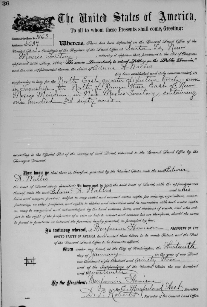
Cause I’m the Tax Man, yeah…
Cash payments secured most of the land patents in the Nob Hill area; however, just because you paid cash didn’t necessarily mean things were all in the clear. At least two of these investments were deemed completely worthless due to some shady activity via the Bernalillo County Treasurer. Henry Lockhart (Parkland Hills Addition) and Virgil Sparks (Ridgecrest Addition) each purchased 80 acres of land from the federal government. Both had their land put up for sale at public auction in 1909 due to $9.35 tax delinquency.
Neither Lockhart, nor Sparks had been informed by the county of the delinquency or the sale of their property. Interestingly, no one bid on either of their tax certificates at public auction, so the land went to the County. In 1917, the County sold both the Lockhart and the Sparks tax certificates to A.E. and Jessie B. McGlashan of Trinidad, Colorado. Upon learning their land had been sold, Sparks and Lockhart each sued the county. Even though Sparks had proof he paid the taxes, the judge ruled against Sparks. The same judge heard the Lockhart case, and, in similar fashion, sided in favor with Bernalillo County.
They weren’t the only ones
A similar situation happened related to the tract of land now known as Granada Heights. Although property taxes had been paid for the first half of 1908, the tax accessor deemed the second half had not been paid on time and sold the tax certificate a public auction. That same year, 1908, Kathleen Patterson and her sister Minnie Byrd had purchased property for $4000 from the original land grant holder, John Lawrence. With the help of M.W. Flournoy, a successful and well-known banker, the sisters managed to reclaim the property in 1910.
According to property research by Patricia Freeman for her books on the Southeast Heights Neighborhoods, a large portion of land south of Central between Carlisle and San Mateo became Bernalillo County property due to tax delinquency related to “unknown” owner between 1906 and 1912.
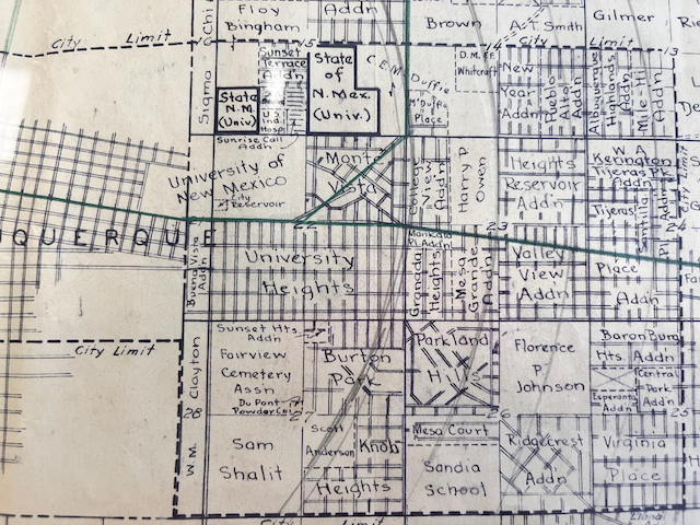
Coincidence? Perhaps. Interestingly, the land claims of Sparks, Lockhart, and Smith, totaling 480 acres, all passed through the hands of a J.L. Flanagan of Dallas, Texas same week in 1920. These acres are now the Mesa Court, Parkland Hills and Ridgecrest Additions.
©️ 2026 Michelle Allison
List of Original Land Patents for Nob Hill Neighborhoods
| Addition | Certificate Holder | Type | Date of Certificate |
| Monte Vista Addition | Joseph Sulzer | Homestead | 1897 |
| College View | William T. Harward | Cash | 1892 |
| Broadmoor | William T. Harward | Cash | 1892 |
| University Heights (east of Girard Ave.) | George F. Albright | Cash | 1891 |
| University Heights (west of Girard Ave.) | Ira T. Williams | Homestead (80 acres) | 1891 |
| Monterey Hills & Sunset Heights | Edwin A. Wallis | Homestead | 1893 |
| Knob Heights | Joseph H. Kuhns | Cash | 1892 |
| Mankato & Granada | John Lawrence | Homestead (80 acres) | 1893 |
| Parkland Hills | Henry Lockhart | Cash | 1894 |
| Mesa Court | James Sheppard Smith | Cash | 1893 |
| Ridgecrest & Keystone | Virgil Sparks | Cash | 1908 |
| Valley View | Johnson and Pohmer | Script Warrant | 1895 |
| Mesa Grande | Albert S. Miller | Cash | 1901 |
| Victory Hills | Edward T. Bliss | Cash | 1890 |